
Thank you for supporting this site ❤️
Make a donation
Make a donation
Gear up for your next adventure:
As an Amazon Associate, this site earns from qualifying purchases at no extra cost to you.
Makiling topographic map
Click on the map to display elevation.
Thank you for supporting this site ❤️
Make a donation
Make a donation
Gear up for your next adventure:
As an Amazon Associate, this site earns from qualifying purchases at no extra cost to you.
About this map
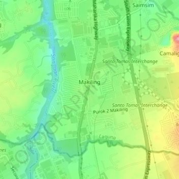
Name: Makiling topographic map, elevation, terrain.
Location: Makiling, Calamba, Laguna, Calabarzon, 4027, Philippines (14.14090 121.12844 14.16539 121.15961)
Average elevation: 136 m
Minimum elevation: 87 m
Maximum elevation: 214 m
Thank you for supporting this site ❤️
Make a donation
Make a donation
Gear up for your next adventure:
As an Amazon Associate, this site earns from qualifying purchases at no extra cost to you.