Geolocate

Pacifica topographic map

Click on the map to display elevation.

About this map
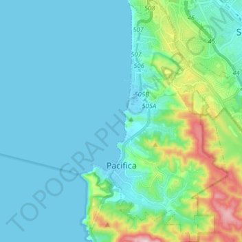
Name: Pacifica topographic map, elevation, terrain.

Location: Pacifica, San Mateo County, CAL Fire Northern Region, California, 94044, United States (37.56634 -122.51538 37.66664 -122.44393)

Average elevation: 76 m

Minimum elevation: -1 m

Maximum elevation: 457 m

Other topographic maps

Click on a map to view its topography, its elevation and its terrain.
Gear up for your next adventure:

🧼Biodegradable Soaps - Eco‑friendly soap for backpacking
🧤Thermal Gloves - Warm gloves for cold weather
🧊Hydration Reservoirs - Easy drinking on the move with 2L or 3L bladders
🦯Lightweight Trekking Poles - Reduce knee strain on steep Wicklow or Kerry slopes
🩹Compact First Aid Kits - Treat blisters and minor injuries on the trail

As an Amazon Associate, this site earns from qualifying purchases at no extra cost to you.