
Thank you for supporting this site ❤️
Make a donation
Make a donation
Gear up for your next adventure:
As an Amazon Associate, this site earns from qualifying purchases at no extra cost to you.
Dallgow-Döberitz topographic map
Click on the map to display elevation.
Thank you for supporting this site ❤️
Make a donation
Make a donation
Gear up for your next adventure:
As an Amazon Associate, this site earns from qualifying purchases at no extra cost to you.
About this map
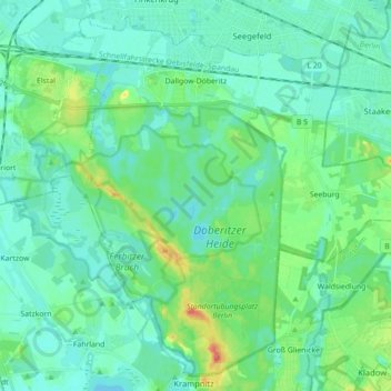
Name: Dallgow-Döberitz topographic map, elevation, terrain.
Location: Dallgow-Döberitz, Havelland, Brandenburg, 14624, Germany (52.45931 12.99206 52.55828 13.16882)
Average elevation: 39 m
Minimum elevation: 26 m
Maximum elevation: 87 m
Thank you for supporting this site ❤️
Make a donation
Make a donation
Gear up for your next adventure:
As an Amazon Associate, this site earns from qualifying purchases at no extra cost to you.