
Make a donation
Gear up for your next adventure:
As an Amazon Associate, this site earns from qualifying purchases at no extra cost to you.
Texas County topographic map
Click on the map to display elevation.
Make a donation
Gear up for your next adventure:
As an Amazon Associate, this site earns from qualifying purchases at no extra cost to you.
About this map
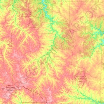
Name: Texas County topographic map, elevation, terrain.
Location: Texas County, Missouri, United States (37.04884 -92.25236 37.60643 -91.64662)
Average elevation: 383 m
Minimum elevation: 261 m
Maximum elevation: 502 m
Make a donation
Gear up for your next adventure:
As an Amazon Associate, this site earns from qualifying purchases at no extra cost to you.
Other topographic maps
Click on a map to view its topography, its elevation and its terrain.
Mother Nature's Crack
United States > Missouri > Newton County > Joplin > Cliff Village
Average elevation: 296 m
Make a donation
Gear up for your next adventure:
As an Amazon Associate, this site earns from qualifying purchases at no extra cost to you.