
Thank you for supporting this site ❤️
Make a donation
Make a donation
Gear up for your next adventure:
As an Amazon Associate, this site earns from qualifying purchases at no extra cost to you.
Taunusstein topographic map
Click on the map to display elevation.
Thank you for supporting this site ❤️
Make a donation
Make a donation
Gear up for your next adventure:
As an Amazon Associate, this site earns from qualifying purchases at no extra cost to you.
About this map
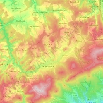
Name: Taunusstein topographic map, elevation, terrain.
Location: Taunusstein, Rheingau-Taunus-Kreis, Hesse, 65232, Germany (50.09365 8.09805 50.22134 8.24305)
Average elevation: 392 m
Minimum elevation: 148 m
Maximum elevation: 621 m
Thank you for supporting this site ❤️
Make a donation
Make a donation
Gear up for your next adventure:
As an Amazon Associate, this site earns from qualifying purchases at no extra cost to you.