
Thank you for supporting this site ❤️
Make a donation
Make a donation
Gear up for your next adventure:
As an Amazon Associate, this site earns from qualifying purchases at no extra cost to you.
Oberelsbach topographic map
Click on the map to display elevation.
Thank you for supporting this site ❤️
Make a donation
Make a donation
Gear up for your next adventure:
As an Amazon Associate, this site earns from qualifying purchases at no extra cost to you.
About this map
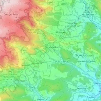
Name: Oberelsbach topographic map, elevation, terrain.
Location: Oberelsbach, Landkreis Rhön-Grabfeld, Bavaria, 97656, Germany (50.39151 9.98798 50.48189 10.16309)
Average elevation: 472 m
Minimum elevation: 275 m
Maximum elevation: 902 m
Thank you for supporting this site ❤️
Make a donation
Make a donation
Gear up for your next adventure:
As an Amazon Associate, this site earns from qualifying purchases at no extra cost to you.