Geolocate

Crystal River topographic map

Click on the map to display elevation.

About this map
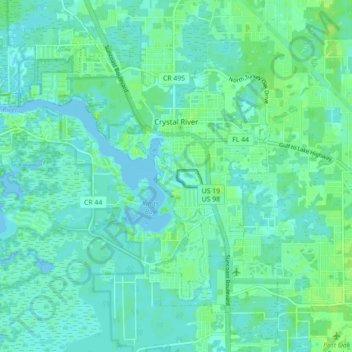
Name: Crystal River topographic map, elevation, terrain.

Location: Crystal River, Citrus County, Florida, 34429, United States (28.85482 -82.65534 28.92593 -82.56712)

Average elevation: 4 m

Minimum elevation: -2 m

Maximum elevation: 12 m

Other topographic maps

Click on a map to view its topography, its elevation and its terrain.
Gear up for your next adventure:

🚶‍♂️Trekking Poles - Supportive poles for stability on varied terrain
🧭Route Planning Books - Plan the best hiking routes
🎒Surveyor High-Vis Vests - Multi-pocket safety vests for field professionals
🚨High-Decibel Whistles - Standard safety gear for mountain signaling
🕶️Polarized Sunglasses - Reduce glare from lakes and sea cliffs

As an Amazon Associate, this site earns from qualifying purchases at no extra cost to you.