Geolocate

Keswick topographic map

Click on the map to display elevation.

About this map
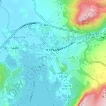
Name: Keswick topographic map, elevation, terrain.

Location: Keswick, Cumberland, England, United Kingdom (54.58732 -3.16352 54.61249 -3.09942)

Average elevation: 128 m

Minimum elevation: 71 m

Maximum elevation: 369 m

Other topographic maps

Click on a map to view its topography, its elevation and its terrain.
Carlisle

United Kingdom > England > Cumberland

Average elevation: 31 m

Gear up for your next adventure:

🪵Fire Starters & Tools - Tools to start fire in wet conditions
📱Phone Holders for Biking - Secure phone mounts for touring cyclists
🗺️Irish Road Atlases - Comprehensive physical maps for road trips and navigation
🔒Outdoor Gear Locks - Secure your equipment
⛺Ultralight Hiking Tents - Compact shelters for multi-day wild camping in Ireland

As an Amazon Associate, this site earns from qualifying purchases at no extra cost to you.