
Thank you for supporting this site ❤️
Make a donation
Make a donation
Gear up for your next adventure:
As an Amazon Associate, this site earns from qualifying purchases at no extra cost to you.
Griesheim topographic map
Click on the map to display elevation.
Thank you for supporting this site ❤️
Make a donation
Make a donation
Gear up for your next adventure:
As an Amazon Associate, this site earns from qualifying purchases at no extra cost to you.
About this map
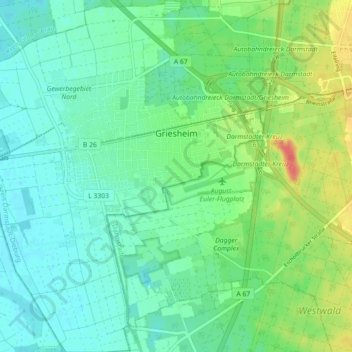
Name: Griesheim topographic map, elevation, terrain.
Location: Griesheim, Landkreis Darmstadt-Dieburg, Hesse, 64347, Germany (49.82554 8.51986 49.88342 8.60264)
Average elevation: 103 m
Minimum elevation: 87 m
Maximum elevation: 141 m
Thank you for supporting this site ❤️
Make a donation
Make a donation
Gear up for your next adventure:
As an Amazon Associate, this site earns from qualifying purchases at no extra cost to you.