Geolocate

Tala topographic map

Click on the map to display elevation.

About this map
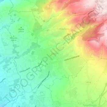
Name: Tala topographic map, elevation, terrain.

Location: Tala, Κοινότητα Τάλας, Paphos District, Cyprus, 8577, Cyprus (34.81613 32.41098 34.85613 32.45098)

Average elevation: 286 m

Minimum elevation: 56 m

Maximum elevation: 637 m

Gear up for your next adventure:

📡Satellite Messengers - Emergency messaging when off‑grid
🔌Fast Car Chargers - Recharge GPS and phones between trailheads
🍽️Camping Utensil Sets - Complete eating sets
💧Portable Water Filters - Safe drinking water from streams and lakes
🪀Camping Games - Fun for group camping trips

As an Amazon Associate, this site earns from qualifying purchases at no extra cost to you.