
Toledo topographic map
Interactive map
Click on the map to display elevation.
About this map
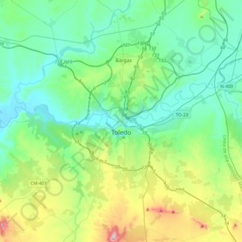
Name: Toledo topographic map, elevation, terrain.
Location: Toledo, Castile-La Mancha, Spain (39.81204 -4.17906 39.92543 -3.81469)
Average elevation: 577 m
Minimum elevation: 431 m
Maximum elevation: 1,072 m