Geolocate

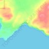
Binningup topographic map

Click on the map to display elevation.

About this map

Name: Binningup topographic map, elevation, terrain.

Location: Binningup, Shire Of Harvey, Western Australia, Australia (-33.17571 115.68293 -33.10690 115.77153)

Average elevation: 7 m

Minimum elevation: -2 m

Maximum elevation: 41 m

Other topographic maps

Click on a map to view its topography, its elevation and its terrain.
Giants Causeway

Australia > Western Australia

Average elevation: 17 m

Surfers Cove

Australia > Western Australia

Average elevation: 38 m

Gear up for your next adventure:

🧥Waterproof Hiking Jackets - Rain jackets for unpredictable weather
📚Irish Walking Guides - The best mapped trails in Wicklow, Kerry, and Connemara
🧿Weather Radios - Track weather in remote places
🌧️Rain Gear for Hiking - Waterproof gear sets for wet hikes
📊Altimeters & Barometers - Track elevation and weather changes

As an Amazon Associate, this site earns from qualifying purchases at no extra cost to you.