Geolocate

Ascot topographic map

Click on the map to display elevation.

About this map
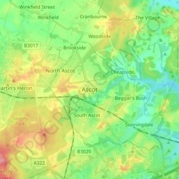
Name: Ascot topographic map, elevation, terrain.

Location: Ascot, Royal Borough of Windsor and Maidenhead, England, SL5 7FW, United Kingdom (51.37013 -0.70802 51.45013 -0.62802)

Average elevation: 72 m

Minimum elevation: 37 m

Maximum elevation: 130 m

Other topographic maps

Click on a map to view its topography, its elevation and its terrain.

Gear up for your next adventure:

🚲Cycling GPS Computers - Topographic mapping for Irish road and mountain biking
🪶Down Jackets - Warm jackets for cold outdoor trips
🛌Cold Weather Sleeping Bags - Warm sleeping bags for colder hikes
☕Vacuum Insulated Flasks - Keep tea or coffee hot for 12 hours on the summit
🧤Touchscreen Glove Liners - Use your mapping app without freezing your hands

As an Amazon Associate, this site earns from qualifying purchases at no extra cost to you.