
Loulé topographic map
Interactive map
Click on the map to display elevation.
Loulé
Loulé is well known for the sandy beaches, such as Quarteira. Inland, Loulé shows a rich geology, paleontology, and wildlife. The seat of the municipality, the city of Loulé proper, is about 10 kilometres inland from the nearest coast at an elevation exceeding 100 meters and higher.
About this map
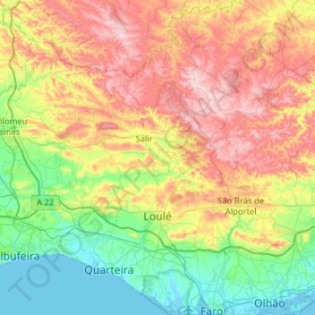
Name: Loulé topographic map, elevation, terrain.
Location: Loulé, Faro, Portugal (37.01048 -8.23201 37.41826 -7.87828)
Average elevation: 206 m
Minimum elevation: -2 m
Maximum elevation: 588 m