
Thank you for supporting this site ❤️
Make a donation
Make a donation
Gear up for your next adventure:
As an Amazon Associate, this site earns from qualifying purchases at no extra cost to you.
Le Morne-Rouge topographic map
Click on the map to display elevation.
Thank you for supporting this site ❤️
Make a donation
Make a donation
Gear up for your next adventure:
As an Amazon Associate, this site earns from qualifying purchases at no extra cost to you.
About this map
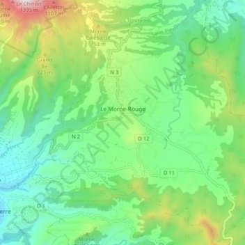
Name: Le Morne-Rouge topographic map, elevation, terrain.
Location: Le Morne-Rouge, Saint-Pierre, Martinique, 97260, France (14.73101 -61.15851 14.80827 -61.08483)
Average elevation: 412 m
Minimum elevation: 15 m
Maximum elevation: 1,339 m
Thank you for supporting this site ❤️
Make a donation
Make a donation
Gear up for your next adventure:
As an Amazon Associate, this site earns from qualifying purchases at no extra cost to you.
Other topographic maps
Click on a map to view its topography, its elevation and its terrain.