
Minle topographic map
Interactive map
Click on the map to display elevation.
About this map
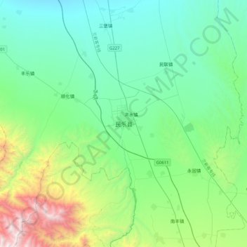
Name: Minle topographic map, elevation, terrain.
Location: Minle, Minle County, Zhangye, Gansu, 734500, China (38.27040 100.65144 38.59040 100.97144)
Average elevation: 2,484 m
Minimum elevation: 1,935 m
Maximum elevation: 4,514 m