
Thank you for supporting this site ❤️
Make a donation
Make a donation
Gear up for your next adventure:
As an Amazon Associate, this site earns from qualifying purchases at no extra cost to you.
Doubs topographic map
Click on the map to display elevation.
Thank you for supporting this site ❤️
Make a donation
Make a donation
Gear up for your next adventure:
As an Amazon Associate, this site earns from qualifying purchases at no extra cost to you.
About this map
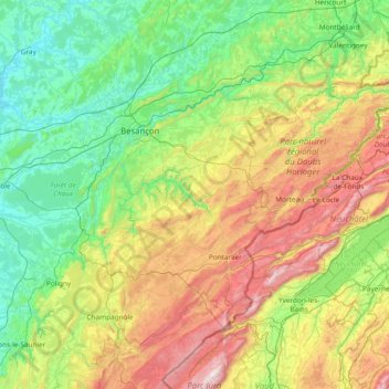
Name: Doubs topographic map, elevation, terrain.
Location: Doubs, Bourgogne-Franche-Comté, Metropolitan France, France (46.55395 5.69876 47.57996 7.06237)
Average elevation: 572 m
Minimum elevation: 185 m
Maximum elevation: 1,660 m
Thank you for supporting this site ❤️
Make a donation
Make a donation
Gear up for your next adventure:
As an Amazon Associate, this site earns from qualifying purchases at no extra cost to you.