
Thank you for supporting this site ❤️
Make a donation
Make a donation
Gear up for your next adventure:
As an Amazon Associate, this site earns from qualifying purchases at no extra cost to you.
Palemig topographic map
Click on the map to display elevation.
Thank you for supporting this site ❤️
Make a donation
Make a donation
Gear up for your next adventure:
As an Amazon Associate, this site earns from qualifying purchases at no extra cost to you.
About this map
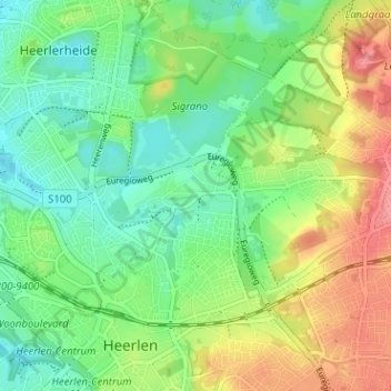
Name: Palemig topographic map, elevation, terrain.
Location: Palemig, Heerlen, Limburg, Netherlands, 6415 RX, Netherlands (50.88299 5.96792 50.92299 6.00792)
Average elevation: 115 m
Minimum elevation: 84 m
Maximum elevation: 164 m
Thank you for supporting this site ❤️
Make a donation
Make a donation
Gear up for your next adventure:
As an Amazon Associate, this site earns from qualifying purchases at no extra cost to you.