
Falmouth topographic map
Interactive map
Click on the map to display elevation.
About this map
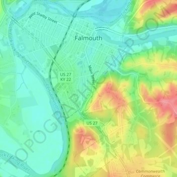
Name: Falmouth topographic map, elevation, terrain.
Location: Falmouth, Pendleton County, Kentucky, 41040, United States (38.65422 -84.34672 38.68285 -84.32125)
Average elevation: 187 m
Minimum elevation: 155 m
Maximum elevation: 246 m