Geolocate

Thimbleby & Osmotherly Show field topographic map

Click on the map to display elevation.

About this map
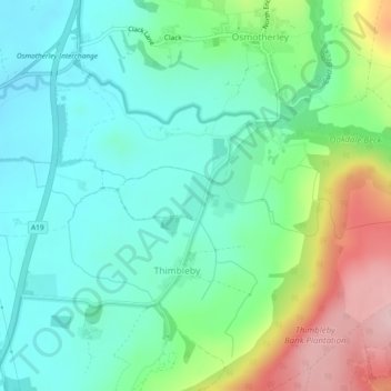
Name: Thimbleby & Osmotherly Show field topographic map, elevation, terrain.

Location: Thimbleby & Osmotherly Show field, Thimbleby, North Yorkshire, York and North Yorkshire, England, United Kingdom (54.35592 -1.30874 54.35909 -1.30531)

Average elevation: 152 m

Minimum elevation: 90 m

Maximum elevation: 303 m

Gear up for your next adventure:

📚Irish Walking Guides - The best mapped trails in Wicklow, Kerry, and Connemara
🪓Camping Axes & Hatchets - Wood cutting tools for campsite prep
🎒Waterproof Backpacks - Protect your gear from rain on Irish hikes
🔦Everyday Carry Torches - Reliable backup light for your hiking pack
🧴Anti-Chafe Sticks - Prevent friction during long distance walking

As an Amazon Associate, this site earns from qualifying purchases at no extra cost to you.