
Saint-Martin-de-l'Arçon topographic map
Interactive map
Click on the map to display elevation.
About this map
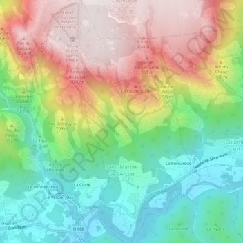
Name: Saint-Martin-de-l'Arçon topographic map, elevation, terrain.
Average elevation: 531 m
Minimum elevation: 127 m
Maximum elevation: 1,066 m
Other topographic maps
Click on a map to view its topography, its elevation and its terrain.