
Thank you for supporting this site ❤️
Make a donation
Make a donation
Gear up for your next adventure:
As an Amazon Associate, this site earns from qualifying purchases at no extra cost to you.
Ciapus topographic map
Click on the map to display elevation.
Thank you for supporting this site ❤️
Make a donation
Make a donation
Gear up for your next adventure:
As an Amazon Associate, this site earns from qualifying purchases at no extra cost to you.
About this map
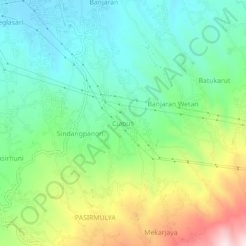
Name: Ciapus topographic map, elevation, terrain.
Location: Ciapus, Bandung, West Java, Java, 40374, Indonesia (-7.09571 107.57382 -7.05571 107.61382)
Average elevation: 849 m
Minimum elevation: 670 m
Maximum elevation: 1,221 m
Thank you for supporting this site ❤️
Make a donation
Make a donation
Gear up for your next adventure:
As an Amazon Associate, this site earns from qualifying purchases at no extra cost to you.