
Grad Omiš topographic map
Interactive map
Click on the map to display elevation.
About this map
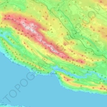
Name: Grad Omiš topographic map, elevation, terrain.
Location: Grad Omiš, Split-Dalmatia County, Croatia (43.39745 16.60538 43.56839 16.89466)
Average elevation: 330 m
Minimum elevation: -5 m
Maximum elevation: 1,324 m
Other topographic maps
Click on a map to view its topography, its elevation and its terrain.