Geolocate

Purok IV topographic map

Click on the map to display elevation.

About this map
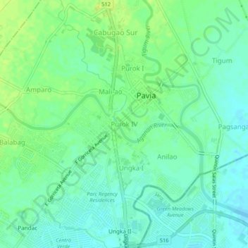
Name: Purok IV topographic map, elevation, terrain.

Location: Purok IV, Pavia, Iloilo, Western Visayas, 5001, Philippines (10.75018 122.51831 10.79018 122.55831)

Average elevation: 16 m

Minimum elevation: 9 m

Maximum elevation: 24 m

Other topographic maps

Click on a map to view its topography, its elevation and its terrain.

Aganan River

Philippines > Iloilo > Pavia > Purok IV

Average elevation: 16 m

Plaza Pavia

Philippines > Iloilo > Pavia > Purok III

Average elevation: 17 m

Ungka I

Philippines > Iloilo > Pavia > Anilao

Average elevation: 15 m

Gear up for your next adventure:

🌦️Weatherproof Outdoor Gear - Protection from unpredictable weather
💧Portable Water Filters - Safe drinking water from streams and lakes
📚Travel Books Ireland - Best travel books for Irish exploration
🔭Portable Monoculars - One-handed optics for quick route checking
🧯Portable Extinguishers - Safety tools for campfires

As an Amazon Associate, this site earns from qualifying purchases at no extra cost to you.