
Thank you for supporting this site ❤️
Make a donation
Make a donation
Gear up for your next adventure:
As an Amazon Associate, this site earns from qualifying purchases at no extra cost to you.
Surcubamba topographic map
Click on the map to display elevation.
Thank you for supporting this site ❤️
Make a donation
Make a donation
Gear up for your next adventure:
As an Amazon Associate, this site earns from qualifying purchases at no extra cost to you.
About this map
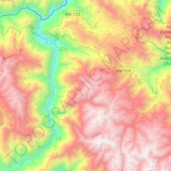
Name: Surcubamba topographic map, elevation, terrain.
Location: Surcubamba, Province of Tayacaja, Huancavelica, Peru (-12.28873 -74.75907 -12.03044 -74.52184)
Average elevation: 2,922 m
Minimum elevation: 1,099 m
Maximum elevation: 4,572 m
Thank you for supporting this site ❤️
Make a donation
Make a donation
Gear up for your next adventure:
As an Amazon Associate, this site earns from qualifying purchases at no extra cost to you.