Geolocate

Blyth topographic map

Click on the map to display elevation.

About this map

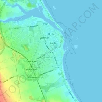
Name: Blyth topographic map, elevation, terrain.

Location: Blyth, Northumberland, North of Tyne, England, United Kingdom (55.09630 -1.58667 55.13922 -1.48934)

Average elevation: 8 m

Minimum elevation: -3 m

Maximum elevation: 47 m

Other topographic maps

Click on a map to view its topography, its elevation and its terrain.

Plenmeller

United Kingdom > England > Northumberland

Average elevation: 156 m

Gear up for your next adventure:

🔦Everyday Carry Torches - Reliable backup light for your hiking pack
🧴Hiking Sunscreen - Sun protection for long exposure
🎒Backpack Rain Covers - Extra protection for non-waterproof rucksacks
🧉Camping Coffee Gear - Enjoy coffee outdoors
🧦Merino Wool Socks - Moisture-wicking and blister-preventing trail socks

As an Amazon Associate, this site earns from qualifying purchases at no extra cost to you.