Geolocate

Tala topographic map

Click on the map to display elevation.

About this map
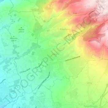
Name: Tala topographic map, elevation, terrain.

Location: Tala, Κοινότητα Τάλας, Paphos District, Cyprus, 8577, Cyprus (34.81613 32.41098 34.85613 32.45098)

Average elevation: 286 m

Minimum elevation: 56 m

Maximum elevation: 637 m

Gear up for your next adventure:

👣Orthopedic Boot Insoles - Extra comfort for long distance walking
🧴Long-Lasting Sunscreen - Protect against UV rays during long days on the ridges
🩹Compact First Aid Kits - Treat blisters and minor injuries on the trail
📈Fitness Trackers - Monitor activity and hike metrics
🧿Weather Radios - Track weather in remote places

As an Amazon Associate, this site earns from qualifying purchases at no extra cost to you.