
Make a donation
Gear up for your next adventure:
As an Amazon Associate, this site earns from qualifying purchases at no extra cost to you.
Hudson topographic map
Click on the map to display elevation.
Make a donation
Gear up for your next adventure:
As an Amazon Associate, this site earns from qualifying purchases at no extra cost to you.
Hudson
Hudson's sea-level elevation and position next to the Gulf of Mexico shape its climate. The average temperature in Hudson can range from 60.3 °F (15.7 °C) in the winter to 80.7 °F (27.1 °C) in the summer.
Make a donation
Gear up for your next adventure:
As an Amazon Associate, this site earns from qualifying purchases at no extra cost to you.
About this map
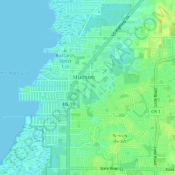
Name: Hudson topographic map, elevation, terrain.
Location: Hudson, Pasco County, Florida, 34667, United States (28.33816 -82.72364 28.37833 -82.65768)
Average elevation: 5 m
Minimum elevation: -1 m
Maximum elevation: 15 m
Make a donation
Gear up for your next adventure:
As an Amazon Associate, this site earns from qualifying purchases at no extra cost to you.