
Make a donation
Gear up for your next adventure:
As an Amazon Associate, this site earns from qualifying purchases at no extra cost to you.
Isthmus of Tehuantepec topographic map
Click on the map to display elevation.
Make a donation
Gear up for your next adventure:
As an Amazon Associate, this site earns from qualifying purchases at no extra cost to you.
Isthmus of Tehuantepec
At its narrowest point, the isthmus is 200 km (124 mi) across from gulf to gulf, or 192 km (119 mi) to the head of Laguna Superior on the Pacific coast. The Sierra Madre del Sur mountain range breaks down at this point into a broad, plateau-like ridge, whose elevation, at the highest point reached by the Ferrocarril Transistmico railway at Chivela Pass, is 224 m (735 ft). The northern side of the isthmus is swampy and densely covered with jungle, which has been a greater obstacle to railway construction than the grades in crossing the sierra.
Make a donation
Gear up for your next adventure:
As an Amazon Associate, this site earns from qualifying purchases at no extra cost to you.
About this map
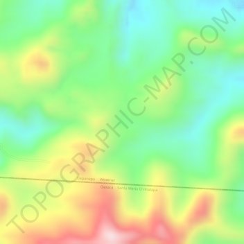
Name: Isthmus of Tehuantepec topographic map, elevation, terrain.
Location: Isthmus of Tehuantepec, Uxpanapa, Veracruz, Mexico (17.17358 -94.60054 17.19358 -94.58054)
Average elevation: 277 m
Minimum elevation: 124 m
Maximum elevation: 483 m
Make a donation
Gear up for your next adventure:
As an Amazon Associate, this site earns from qualifying purchases at no extra cost to you.