
Gżira topographic map
Interactive map
Click on the map to display elevation.
About this map
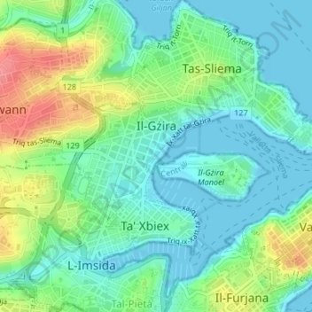
Name: Gżira topographic map, elevation, terrain.
Location: Gżira, Central Region, Malta (35.90045 14.48727 35.90981 14.50832)
Average elevation: 25 m
Minimum elevation: 0 m
Maximum elevation: 82 m