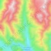
Gudauri topographic map
Click on the map to display elevation.
Gudauri
Gudauri (Georgian: გუდაური) is a ski resort located on the south-facing plateau of The Greater Caucasus Mountain Range in Georgia. The resort is situated in the Stepantsminda District, along the Georgian Military Highway near the Jvari Pass, at an elevation of 2,200 meters (7,200 ft.) above sea level. Gudauri lies 120 km (75 mi) to the north of the Georgian capital Tbilisi. Gudauri is 4.1 km away from the nearest borderline to with the unrecognized South Ossetia. The slopes of Gudauri are above the tree line and considered to be avalanche-safe. The ski season lasts from December to April. Heliskiing is available throughout the season.
About this map

Name: Gudauri topographic map, elevation, terrain.
Average elevation: 2,161 m
Minimum elevation: 1,591 m
Maximum elevation: 2,849 m
Other topographic maps
Click on a map to view its topography, its elevation and its terrain.