

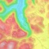
Hülben topographic map
Click on the map to display elevation.
Hülben
The Hülben stalactite cave was discovered during the construction of national road Bad Urach-Hülben on September 19, 1978, it is a stalactite cave with stalactites and stalagmites. An about 5 m deep shaft leads into the easily accessible part of the cave. This has about room size, but with only partial low altitude.
About this map

Name: Hülben topographic map, elevation, terrain.
Average elevation: 667 m
Minimum elevation: 486 m
Maximum elevation: 733 m
Other topographic maps
Click on a map to view its topography, its elevation and its terrain.

Kleinengstingen
Germany > Baden-Württemberg > Landkreis Reutlingen > Kleinengstingen
Average elevation: 730 m