
Thank you for supporting this site ❤️
Make a donation
Make a donation
Gear up for your next adventure:
As an Amazon Associate, this site earns from qualifying purchases at no extra cost to you.
Argenteuil topographic map
Click on the map to display elevation.
Thank you for supporting this site ❤️
Make a donation
Make a donation
Gear up for your next adventure:
As an Amazon Associate, this site earns from qualifying purchases at no extra cost to you.
About this map
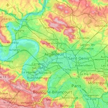
Name: Argenteuil topographic map, elevation, terrain.
Location: Argenteuil, Val-d'Oise, Metropolitan France, 95100, France (48.78791 2.08818 49.10791 2.40818)
Average elevation: 79 m
Minimum elevation: 18 m
Maximum elevation: 197 m
Thank you for supporting this site ❤️
Make a donation
Make a donation
Gear up for your next adventure:
As an Amazon Associate, this site earns from qualifying purchases at no extra cost to you.