
Thank you for supporting this site ❤️
Make a donation
Make a donation
Gear up for your next adventure:
As an Amazon Associate, this site earns from qualifying purchases at no extra cost to you.
Rhes-y-cae topographic map
Click on the map to display elevation.
Thank you for supporting this site ❤️
Make a donation
Make a donation
Gear up for your next adventure:
As an Amazon Associate, this site earns from qualifying purchases at no extra cost to you.
About this map
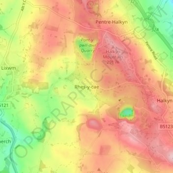
Name: Rhes-y-cae topographic map, elevation, terrain.
Location: Rhes-y-cae, Flintshire, Wales, CH8 8JQ, United Kingdom (53.20892 -3.23668 53.24892 -3.19668)
Average elevation: 225 m
Minimum elevation: 119 m
Maximum elevation: 303 m
Thank you for supporting this site ❤️
Make a donation
Make a donation
Gear up for your next adventure:
As an Amazon Associate, this site earns from qualifying purchases at no extra cost to you.