
Budatétény topographic map
Interactive map
Click on the map to display elevation.
About this map
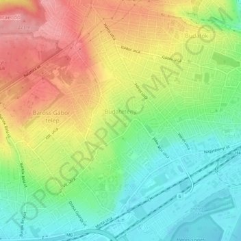
Name: Budatétény topographic map, elevation, terrain.
Location: Budatétény, 22nd district, Budapest, Central Hungary, Hungary (47.39934 18.99390 47.43235 19.03290)
Average elevation: 147 m
Minimum elevation: 97 m
Maximum elevation: 209 m
Other topographic maps
Click on a map to view its topography, its elevation and its terrain.