
A Coruña topographic map
Interactive map
Click on the map to display elevation.
About this map
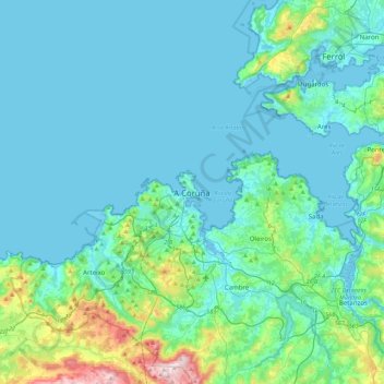
Name: A Coruña topographic map, elevation, terrain.
Location: A Coruña, Galicia, 15001, Spain (43.21121 -8.55588 43.53121 -8.23588)
Average elevation: 67 m
Minimum elevation: -7 m
Maximum elevation: 519 m