Tempe topographic map
Click on the map to display elevation.
Tempe
Tempe is generally flat, except for Tempe Butte or Hayden Butte (generally known as A-Mountain for Arizona State University's "A" logo located on its south face), located next to Sun Devil Stadium, Twin Buttes and Bell Butte on the western edge of Tempe, and the buttes within Papago Park at northwest corner of Tempe. Elevation ranges from 1,140 feet (350 m) at Tempe Town Lake to 1,495 feet (456 m) atop Hayden Butte.
About this map
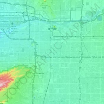
Name: Tempe topographic map, elevation, terrain.
Location: Tempe, Maricopa County, Arizona, United States (33.32004 -111.97849 33.46533 -111.87743)
Average elevation: 370 m
Minimum elevation: 317 m
Maximum elevation: 708 m
Other topographic maps
Click on a map to view its topography, its elevation and its terrain.