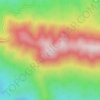
Tserovani topographic map
Click on the map to display elevation.
About this map

Name: Tserovani topographic map, elevation, terrain.
Location: Tserovani, Mtskheta Municipality, Mtskheta-Mtianeti, Georgia (41.87450 44.66515 41.89717 44.71256)
Average elevation: 678 m
Minimum elevation: 497 m
Maximum elevation: 1,074 m
Other topographic maps
Click on a map to view its topography, its elevation and its terrain.

Dzegvi
Georgia > Mtskheta-Mtianeti > Mtskheta Municipality
Dzegvi (Georgian: ძეგვი) is a village in eastern Georgia, in Mtskheta Municipality, Mtskheta-Mtianeti region. It is situated on the right bank of the Mtkvari River, at an elevation of 560 metres above sea level. The village lies 9 kilometres from Mtskheta and 2 kilometres from Dzegvi railway station.
Average elevation: 602 m