
Duće topographic map
Interactive map
Click on the map to display elevation.
About this map
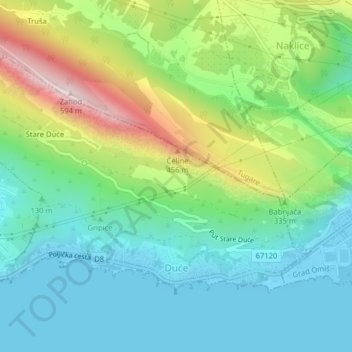
Name: Duće topographic map, elevation, terrain.
Location: Duće, Općina Dugi Rat, Split-Dalmatia County, Croatia (43.43829 16.64135 43.45788 16.68109)
Average elevation: 175 m
Minimum elevation: -3 m
Maximum elevation: 579 m
Other topographic maps
Click on a map to view its topography, its elevation and its terrain.