
Thank you for supporting this site ❤️
Make a donation
Make a donation
Gear up for your next adventure:
As an Amazon Associate, this site earns from qualifying purchases at no extra cost to you.
Restrepo topographic map
Click on the map to display elevation.
Thank you for supporting this site ❤️
Make a donation
Make a donation
Gear up for your next adventure:
As an Amazon Associate, this site earns from qualifying purchases at no extra cost to you.
About this map
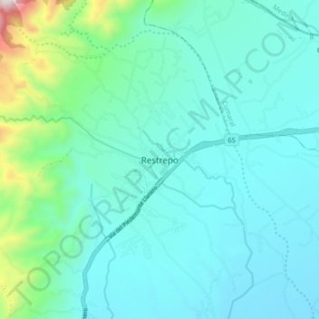
Name: Restrepo topographic map, elevation, terrain.
Location: Restrepo, Piedemonte, Meta, Colombia (4.22159 -73.60304 4.30159 -73.52304)
Average elevation: 553 m
Minimum elevation: 389 m
Maximum elevation: 1,412 m
Thank you for supporting this site ❤️
Make a donation
Make a donation
Gear up for your next adventure:
As an Amazon Associate, this site earns from qualifying purchases at no extra cost to you.