
Gemeinde Vandans topographic map
Interactive map
Click on the map to display elevation.
About this map
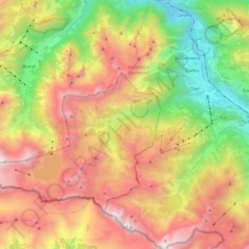
Name: Gemeinde Vandans topographic map, elevation, terrain.
Location: Gemeinde Vandans, Bezirk Bludenz, Vorarlberg, 6773, Austria (47.03125 9.70567 47.11865 9.88795)
Average elevation: 1,646 m
Minimum elevation: 576 m
Maximum elevation: 2,810 m
Other topographic maps
Click on a map to view its topography, its elevation and its terrain.
Montafon
Austria > Vorarlberg > Bezirk Bludenz > Gemeinde Sankt Gallenkirch
Montafon, Gemeinde Sankt Gallenkirch, Bezirk Bludenz, Vorarlberg, 6791, Austria
Average elevation: 1,566 m