Geolocate

Lido topographic map

Click on the map to display elevation.

About this map
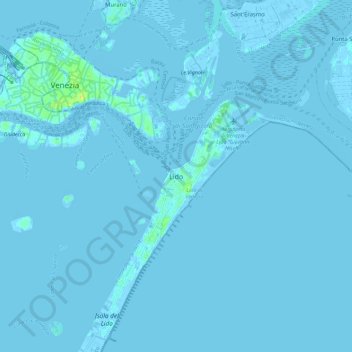
Name: Lido topographic map, elevation, terrain.

Location: Lido, Venice, Venezia, Veneto, 30132, Italy (45.37646 12.33061 45.45646 12.41061)

Average elevation: 0 m

Minimum elevation: -6 m

Maximum elevation: 14 m

Other topographic maps

Click on a map to view its topography, its elevation and its terrain.

Isola San Servolo

Italy > Veneto > Venezia > Venice > Lido

Average elevation: 1 m

Sant'Erasmo

Italy > Veneto > Venezia > Venice > Sant'Erasmo

Average elevation: 0 m

Murano

Italy > Veneto > Venezia > Venice > Murano

Average elevation: 0 m

Canal Grande

Italy > Veneto > Venezia > Venice > Lido

Average elevation: 2 m

Burano

Italy > Veneto > Venezia > Venice > Burano

Average elevation: 0 m

Sant'Erasmo

Italy > Veneto > Venezia > Venice > Sant'Erasmo

Average elevation: 0 m

Gear up for your next adventure:

🧤Thermal Outdoor Gloves - Windproof and waterproof gloves for winter hiking
🛰️Handheld GPS Units - Professional satellite navigation for Irish highlands
🔭Portable Monoculars - One-handed optics for quick route checking
🔦High-Lumen Headlamps - Hands-free lighting for early starts or late finishes
🔧Bicycle Repair Kits - On‑the‑go bike maintenance tools

As an Amazon Associate, this site earns from qualifying purchases at no extra cost to you.