
Parroquia Urimare topographic map
Interactive map
Click on the map to display elevation.
About this map
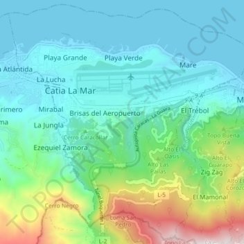
Name: Parroquia Urimare topographic map, elevation, terrain.
Location: Parroquia Urimare, Municipio Vargas, Vargas State, Venezuela (10.55053 -67.03284 10.62423 -66.96082)
Average elevation: 301 m
Minimum elevation: -1 m
Maximum elevation: 1,391 m