
Thank you for supporting this site ❤️
Make a donation
Make a donation
Gear up for your next adventure:
As an Amazon Associate, this site earns from qualifying purchases at no extra cost to you.
Li topographic map
Click on the map to display elevation.
Thank you for supporting this site ❤️
Make a donation
Make a donation
Gear up for your next adventure:
As an Amazon Associate, this site earns from qualifying purchases at no extra cost to you.
About this map
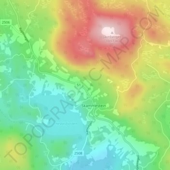
Name: Li topographic map, elevation, terrain.
Location: Li, Skammestein, Øystre Slidre, Innlandet, 2950, Norway (61.18280 8.95768 61.22280 8.99768)
Average elevation: 774 m
Minimum elevation: 589 m
Maximum elevation: 1,088 m
Thank you for supporting this site ❤️
Make a donation
Make a donation
Gear up for your next adventure:
As an Amazon Associate, this site earns from qualifying purchases at no extra cost to you.