
Härjedalens kommun topographic map
Interactive map
Click on the map to display elevation.
About this map
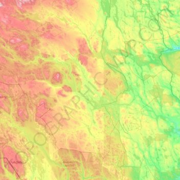
Name: Härjedalens kommun topographic map, elevation, terrain.
Location: Härjedalens kommun, Jämtland County, Region Norrland, Sweden (61.56377 12.05614 62.76480 15.42921)
Average elevation: 533 m
Minimum elevation: 123 m
Maximum elevation: 1,625 m
Other topographic maps
Click on a map to view its topography, its elevation and its terrain.
Östersund
Sweden > Jämtland County > Östersund
Östersund, Jämtland County, Region Norrland, 831 31, Sweden
Average elevation: 341 m
Helagsfjället
Helagsfjället, Berg, Jämtland County, Region Norrland, Sweden
Average elevation: 1,418 m
Åreskutan
Åreskutan, Åre, Jämtland County, Region Norrland, 83752, Sweden
Average elevation: 1,115 m