
Thank you for supporting this site ❤️
Make a donation
Make a donation
Gear up for your next adventure:
As an Amazon Associate, this site earns from qualifying purchases at no extra cost to you.
Momil topographic map
Click on the map to display elevation.
Thank you for supporting this site ❤️
Make a donation
Make a donation
Gear up for your next adventure:
As an Amazon Associate, this site earns from qualifying purchases at no extra cost to you.
About this map
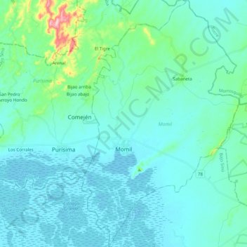
Name: Momil topographic map, elevation, terrain.
Location: Momil, Bajo Sínú, Córdoba, RAP Caribe, Colombia (9.16207 -75.70764 9.35316 -75.56281)
Average elevation: 29 m
Minimum elevation: -2 m
Maximum elevation: 230 m
Thank you for supporting this site ❤️
Make a donation
Make a donation
Gear up for your next adventure:
As an Amazon Associate, this site earns from qualifying purchases at no extra cost to you.
Other topographic maps
Click on a map to view its topography, its elevation and its terrain.
San Fransico de Sicará
Colombia > Córdoba > San Bernardo del Viento > San Fransico de Sicará
Average elevation: 3 m