
Thank you for supporting this site ❤️
Make a donation
Make a donation
Gear up for your next adventure:
As an Amazon Associate, this site earns from qualifying purchases at no extra cost to you.
Heppenheim topographic map
Click on the map to display elevation.
Thank you for supporting this site ❤️
Make a donation
Make a donation
Gear up for your next adventure:
As an Amazon Associate, this site earns from qualifying purchases at no extra cost to you.
About this map
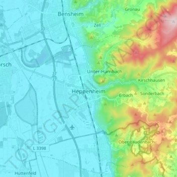
Name: Heppenheim topographic map, elevation, terrain.
Location: Heppenheim, Kreis Bergstraße, Hesse, 64646, Germany (49.60310 8.58889 49.68129 8.73108)
Average elevation: 177 m
Minimum elevation: 89 m
Maximum elevation: 533 m
Thank you for supporting this site ❤️
Make a donation
Make a donation
Gear up for your next adventure:
As an Amazon Associate, this site earns from qualifying purchases at no extra cost to you.