
Make a donation
Gear up for your next adventure:
As an Amazon Associate, this site earns from qualifying purchases at no extra cost to you.
Neukirchen am Großvenediger topographic map
Click on the map to display elevation.
Make a donation
Gear up for your next adventure:
As an Amazon Associate, this site earns from qualifying purchases at no extra cost to you.
Neukirchen am Großvenediger
Neukirchen am Großvenediger is a market town in the district of Zell am See (Pinzgau region), in the state of Salzburg in Austria. Neukirchen is at an altitude of 856 meters and its population (as of May 2001) is 2,616.
Make a donation
Gear up for your next adventure:
As an Amazon Associate, this site earns from qualifying purchases at no extra cost to you.
About this map
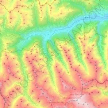
Name: Neukirchen am Großvenediger topographic map, elevation, terrain.
Average elevation: 1,968 m
Minimum elevation: 791 m
Maximum elevation: 3,628 m
Make a donation
Gear up for your next adventure:
As an Amazon Associate, this site earns from qualifying purchases at no extra cost to you.