Geolocate

Heber topographic map

Click on the map to display elevation.

About this map
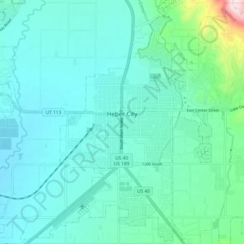
Name: Heber topographic map, elevation, terrain.

Location: Heber, Wasatch County, Utah, 84032, United States (40.47148 -111.44473 40.53675 -111.35712)

Average elevation: 1,737 m

Minimum elevation: 1,662 m

Maximum elevation: 2,170 m

Other topographic maps

Click on a map to view its topography, its elevation and its terrain.

Soldier Summit

United States > Utah > Wasatch County

Average elevation: 2,323 m

Heber City

United States > Utah > Wasatch County

Average elevation: 1,758 m

Heber City

United States > Utah > Wasatch County

Average elevation: 1,758 m

Gear up for your next adventure:

🔒Outdoor Gear Locks - Secure your equipment
💳Travel Cards for Ireland - Convenient payment abroad
🔋Solar Power Banks - Keep your GPS and phone charged in the Irish wilderness
🎒Technical Hiking Daypacks - Ergonomic backpacks with hydration bladder compatibility
🎒Surveyor High-Vis Vests - Multi-pocket safety vests for field professionals

As an Amazon Associate, this site earns from qualifying purchases at no extra cost to you.