Boulder topographic map
Click on the map to display elevation.
Boulder
Boulder is located at the base of the foothills of the Rocky Mountains, at an elevation of 5,430 feet (1,655 m) above sea level. The city is 25 miles (40 km) northwest of the Colorado state capital of Denver. Boulder is a college town, hosting the University of Colorado Boulder, the flagship and largest campus of the University of Colorado system as well as numerous research institutes.
About this map
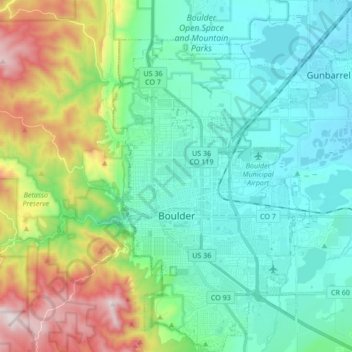
Name: Boulder topographic map, elevation, terrain.
Location: Boulder, Boulder County, Colorado, United States (39.95694 -105.30145 40.09447 -105.17810)
Average elevation: 1,800 m
Minimum elevation: 1,557 m
Maximum elevation: 2,545 m
Other topographic maps
Click on a map to view its topography, its elevation and its terrain.